Trekking tracks
Please read Hostel Rules, section 1 before booking.


In this website you can find the following tracks:
- Mampodre superintegral (long and demanding trail, going through the 13 summits of Mampodre)
- Mampodre circular (long trail, surrounding all the massif, without climbing any summit)
- Direct trail to La Cruz (direct climbing to the highest summit of the Mampodre Massif)
- La Cruz through Mampodre valley and descent through Canalizo (moderate difficulty)
- Circular trail to Peña Hoguera (easy trail; spectacular views)
If you are thinking to do the Mampodre integral track (6 summits) or superintegral track (13 summits), we give you this card to mark the summits you get.
And if you are staying in the Maraña hostel, you can change it for a glass or a mug of beer* , according to the challenge accomplished. As a courtesy from the Maraña Hostel, La Parada. Only for adults.

This track is 19 km long and has an accumulated slope of 4,200 meters. It goes through the 13 main summits of Mampodre, having more than 2,000 meters high:
La Polinosa-La Cruz-La Uve-El Convento-Salamanquino-Cervunal/Valcerrao-La Graya-Bustil-Peña Mediana/Azahara-Peña Brava-Crestón de los Cubos-Pico Mediodía-Valjarto.
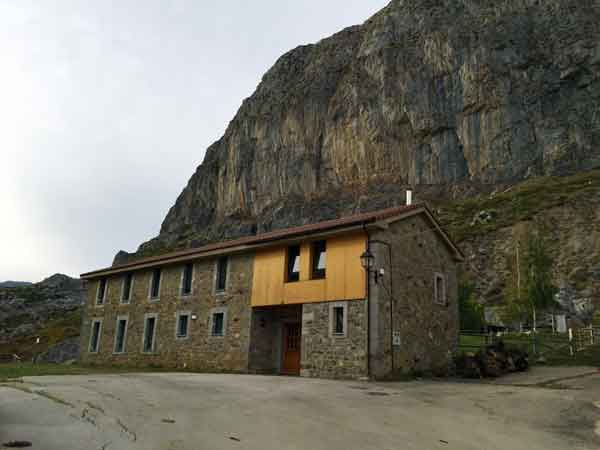
The track starts and ends at the Maraña hostel.
It takes between 8 and 10 hours, on average.
Timely use of III grade climbing devices.
In La Graya descent there is a two-rope rappel, formed by two enchained ropes of 16 m and 12 m. This facility is tied up with a fixed rope provided with knots, facilitating hand grip and descent.
(Note: in July 2017 the fixed rope was new, but it will deteriorate with time; a 35 meter rope should be advisable for the rappels).
This track includes some hills without name, that also are higher than 2,000 meters and deserve to be climbed.
You can obtain the track for the GPS here.
Circular trail, surrounding the Mampodre Massif. It is 23 km long and it has a possitive slope of 1,000 meters. The track starts and ends at the Maraña hostel, La Parada (1,274 m high), although it is also possible to start in Acebedo (approximately, 5 km away) and in Redipollos through Valdepisón (increasing the track in 15 km approximately and + 600 meters of possitive slope).
The highest point of the track is at about 1.880 meters. It takes about six hours.
It is 15 km long and it has a possitive slope of 700 meters.
It starts at Maraña square and goes up to the Tronisco Lagoon. Then, it descents throught the Peña Cagüenzo talweg to Riosol valley. It returns to Maraña surrounding Peña Hoguera.
It takes about five hours.
This track steps on six of the ten main summits of the massif
(they are the six summits of Maraña Council).
This trail has a possitive slope of 1,450 meters and is 14 km long.
It is a variated circular track, provided with a tricky descending step and a IV grade climbing of about two meters high.
It has a moderate difficulty and it takes between six and eight hours, on average.
Mejores tiempos (comprobados) en realizar la integral de Mampodre:
1º- 2horas 32minutos, día 30/07/2018 Arkaitz Ereño
2º 2horas 44minutos, día 20/09/2017 Diego Alonso
Subida al pico de La Cruz por las llombas de la cara norte. La bajada se puede realizar por el camino normal que viene desde el collado de Gistral o por la que viene desde el collado de Valverde (esta última de mayor dificultad).
Esta ruta trascurre por dos valles distintos. La subida por el circo de mampodre y la bajada la realizamos por el Canalizo que nos lleva directos al valle de Maraña. Alrededor de cinco horas.
Ruta circular que sube por el valle de Valverde y baja por el circo de Mampodre atravesando el collado de Valverde. Alrededor de cuatro horas.
Ruta circular que rodea Peña Hoguera. Todo el recorrido transcurre por pista. Menos de dos horas.
Subida a la cima de Peña Hoguera, partiendo desde el albergue de Maraña y bajando de nuevo hasta el albergue por el interior del hayedo de los Reyes. Recorrido por pista, senderos de montaña y terreno de aventura. Duración sobre dos horas.

